Sun Lakes-Dry Falls State Park Overview
The park is a Bortle Scale 2, as it is far away from city lights, meaning that it is very dark and can easily view the Milky Way.
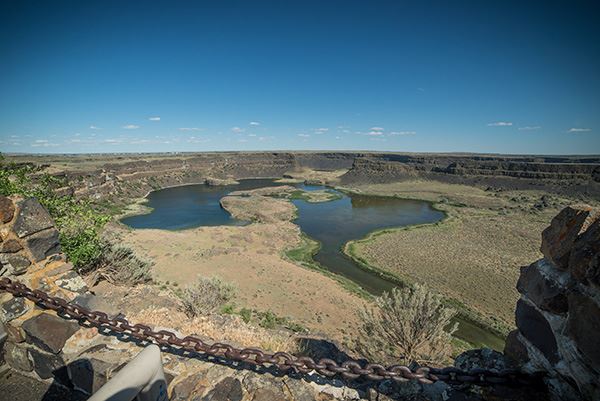
According to the Washington State Parks and Recreation, “Dry Falls is a geological wonder of North America. Carved by Ice Age floods more than 13,000 years ago, the former waterfall was once four times the size of Niagara Falls. Today, the 400-foot-high, 3.5-mile-wide cliff overlooks a big sky and a landscape of deep gorges and dark, reflective lakes. The park is a notable site along the National Ice Age Floods Geologic Trail.
The park also offers great recreation. The lure of Dry Falls Lake entices anglers to cast out for trout. Hiking trails wind through the scented, sage-dotted hills to table-top cliffs with panoramic views.
Sun Lakes-Dry Falls State Park is a 3,774-acre camping park with 73,640 feet of freshwater shoreline at the foot of Dry Falls between Soap Lake and Coulee City.”
Location
- How far outside of Seattle? ~192 miles depending on the route taken. This make the drive around 3 hours and 20 minute drive depending on traffic and stops.
- Google Maps Location
Overnight Accommodations
The park has 96 standard campsites, 41 full-hookup sites, one dump station, six restrooms and 12 showers. Maximum site length is 65 feet (may have limited availability). Park campsites do not have tent pads. All campsites have fire pits.
Weather
The current weather can be found here.
Current Seeing Conditions/Forecast Charts
The following cleardarksky.com forecast from Camp Delany, which is a 3 mile drive away is a great cleardarksky chart close to the park.
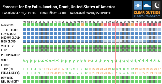
The following Clearoutside can be useful for accurate forecasts.
Make sure to follow us on Twitter and Instagram, and make sure to view our other unique astronomy sites such as this one for more places to view astronomy in the Pacific Northwest.


Be the first to comment on "Sun Lakes-Dry Falls State Park Unique Astronomy Site"