We recently got around to watching the OPB Documentary called “Oregon Moon Country,” which was great! It was a fun program and it was great to see so many esteemed people interviewed such as professors from OU, OSU, and more! One of the familiar faces we saw and was featured was Dr. David Warmflash who we reviewed his great work of Moon: An Illustrated History Book Review.
For those who have yet to see the PBS OPB Documentary, go ahead and check it out here: https://www.opb.org/television/programs/oregonexperience/segment/central-oregon-moon-country-apollo-astronaut-training-nasa/
The documentation takes the time to talk about the role that the volcanic landscape plaid in training the astronauts for the moon, the effect that bringing the astronauts to the area had on the residents, and work that students do today in the area.
Many noticeable and recognizable Bend area institutions, with some dedicated to astronomy were founded and created during this time.
Some of the areas and locations used by the NASA astronauts and featured in the documentary include the following locations, which we will provide information about.
McKenzie Pass – This is a mountain pass in the Cascade Range with an elevation of 5,325 feet. It is noteworthy that on August 1964, Walter Cunningham struggled in a lava flow at McKenzie Pass, where he eventually fell and tore his space suit. Cunningham piloted the lunar module on Apollo 7 in 1968. On the site for visitors is a site that was constructed in 1935, the Dee Wright Observatory is a lava rock structure on the site that allows observers to view 6 Cascade peaks on a clear day.
Paulina Lake – Located within the caldera of Newberry Volcano, about 25 miles south of Bend, Oregon, Paulina Lake is a popular recreation spot with fishing being especially popular.
Newberry Crater, which claims Paulina Lake as part of it, is a shield volcano that last erupted in 690 AD.
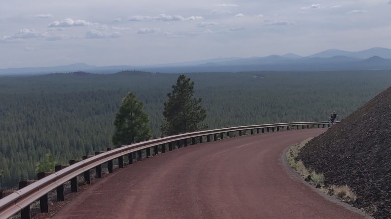
Lava Butte, which is a cinder cone located in the Bend area. From early May to mid October, a shuttle transports visitors up Red Cinder Road from the Lava Lands Visitor Center to the lookout on Lava Butte. Hiking up Red Cinder Road is a year-round option. A scenic rim trail around the top of Lava Butte is .35 miles long.
Fort Rock is a tuff ring located on an ice age lake bed in north Lake County, Oregon, United States. The ring is about 4,460 feet in diameter and stands about 200 feet high above the surrounding plain. The rock and surrounding area is mangled as part of the Fort Rock State Natural Area.
Hole-in-the-Ground is a large maar in the Fort Rock-Christmas Lake Valley Basin of Lake County, central Oregon, northeast of Crater Lake, near Oregon Route 31. There are some nice trails in the area that one can check out.

Be the first to comment on "Oregon Moon Country"