As we previously did articles on the 2024 solar eclipse for the several state parks, and figure that there is an amazing opportunity for mapping those state parks to their Bortle Scale values. With the help of https://www.lightpollutionmap.info, we created the following table to provide information about the entire state parks for Massachusetts in regards to light pollution and astronomy.
| Item | How Many |
| Number Of State Parks | 137 |
| Number of Different Bortle Scales | 6 |
| Level 1 Bortle Scale State Parks | 0 |
| Level 2 Bortle Scale State Parks | 0 |
| Level 3 Bortle Scale State Parks | 3 |
| Level 4 Bortle Scale State Parks | 16 |
| Level 5 Bortle Scale State Parks | 33 |
| Level 6 Bortle Scale State Parks | 20 |
| Level 7 Bortle Scale State Parks | 24 |
| Level 8 Bortle Scale State Parks | 41 |
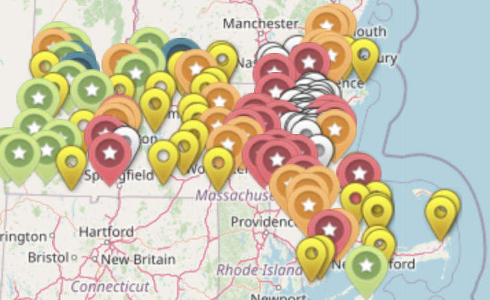
Map
Here is a show of the colors of the markers, to know how to read the map.
| Color | Bortle Scale |
| Black | Level 1 |
| Dark Purple | Level 2 |
| Blue | Level 3 |
| Green | Level 4 |
| Yellow | Level 5 |
| Orange | Level 6 |
| Red | Level 7 |
| White | Level 8 |
To learn more about the Bortle Scale, check out this article. The Massachusetts State Parks official website can be found here.
Be the first to comment on "Massachusetts State Park Light Pollution Map"